Storm Team4 Forecast: Cloudy start to workweek before sunshine makes a comeback
4 things to know about the weather:
- Clouds hang on to start the week
- Gradual warm-up begins
- Sunshine makes a comeback
- Excellent stretch for outdoor plans
Monday stays mostly cloudy and cooler than average as the departing Nor’easter continues to influence the region.
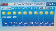
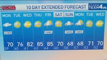
Temperatures climb a little each day, moving from the upper 60s and lower 70s Monday to around 80° by Wednesday.
Download the NBC Washington app on iOS and Android to check the weather radar on the go.
Expect increasing breaks of sun Tuesday, with mostly sunny skies becoming the rule by Wednesday.
Dry weather, comfortable humidity, and light winds make Tuesday and Wednesday the pick of the week for outdoor plans.
QuickCast
MONDAY
Mostly cloudy and cool
Plenty of clouds throughout the day
A stray early shower can’t be ruled out
Cooler than typical late September weather
Dry conditions for most locations
Wind: NW 5 to 10 mph
High Temperature: 69°-72°
MONDAY NIGHT
Mostly cloudy skies
Quiet and dry
Comfortable overnight conditions
Light northwest breeze
Low Temperature: 60°-63°
TUESDAY
Sunnier and nice
Sun and clouds mix together
Dry weather all day long
Pleasant afternoon temperatures
Lower humidity levels continue
Wind: NW 5 to 10 mph
High Temperature: 74°-77°
TUESDAY NIGHT
Partly cloudy skies
Cool and comfortable
Great evening for outside plans
Wind: Light and variable
Low Temperature: 58°-62°
WEDNESDAY
Mostly sunny and beautiful
Plenty of sunshine
Dry all day
Warmer afternoon highs
Wind: Light W to SW 5 to 10 mph
High Temperature: 78°-81°
WEDNESDAY NIGHT
Partly cloudy and mild
Comfortable evening conditions
Dry weather continues
Wind: Light and variable
Low Temperature: 61°-64°