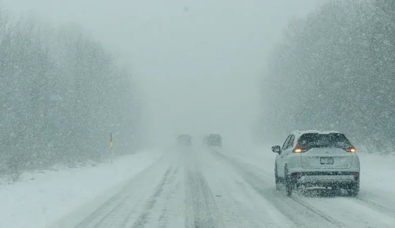
As of January 23, 2026, a massive winter storm is moving across the United States, threatening millions with historic weather conditions. Meteorologists have identified a specific corridor of 12 cities that will face the harshest impacts. The system stretches from the Southern Plains all the way to New England. Forecasters warn of catastrophic ice accumulation in the South and heavy snowfall in the Northeast. This severe weather event poses significant risks to travel, power grids, and public safety throughout the weekend.
Southern Cities Facing Catastrophic Ice
The southern leg of this massive winter storm brings the most dangerous conditions. Freezing rain remains the primary threat for this region. Ice accumulation creates far more structural damage than snow.
Tupelo, Mississippi, stands at the center of the danger zone. Forecasters rated the impact for Tupelo as a 10 out of 10. The city faces projections of “crippling” ice. Accumulations of this magnitude snap heavy tree limbs and crush power infrastructure. Residents should prepare for the likelihood of losing electricity for an extended period.
Little Rock, Arkansas, also faces severe threats. Models show this area receiving some of the worst ice impacts in the entire southern path of the storm. The weight of the ice will likely down numerous power lines. Travel will become impossible as roads turn into sheets of solid glaze.
Dallas-Fort Worth in Texas is bracing for dangerous icing as well. The metropolitan area is vulnerable to grid issues during extreme cold. The ice threatens to paralyze the region’s massive highway system. Authorities in Texas have urged drivers to stay off the roads completely. Even a thin layer of ice renders vehicles uncontrollable.
Memphis, Tennessee, faces a similar outlook. The city expects significant heavy ice accumulation. This creates a high risk for dangerous travel conditions and infrastructure damage. The risk extends eastward into Nashville, Tennessee. Nashville holds a high impact rating of 9 out of 10. The city will likely see a chaotic mix of significant ice and snow. This combination makes cleanup efforts incredibly difficult for road crews.
Charlotte and the Power Grid Threat
Further east, Charlotte, North Carolina, sits in the crosshairs of the storm. Meteorologists are bracing the city for a major ice event. The primary concern for Charlotte involves widespread, long-lasting power outages.
Ice storms in the Carolinas notoriously devastate the electrical grid. The sheer weight of ice on pine trees causes them to fall onto transmission lines. Repair crews often cannot work safely until the ice stops falling. Consequently, residents could face days without heat.
Utility companies across the South have prepositioned trucks and linemen. However, the scale of this massive winter storm may overwhelm local resources. Emergency management officials advise families to keep mobile devices charged. They also recommend securing non-perishable food and flashlights immediately.
Heavy Snowfall Hits the Northeast and Midwest
As the system moves north, the precipitation turns to snow. The impacts here shift from ice damage to travel shutdowns.
Washington, D.C., sits right on the transition line. The capital region expects 6 to 10 inches of snow. However, suburbs could see higher totals. Significant icing may also mix in with the snow. This creates a heavy, slushy mess that is difficult to plow. Government operations and commute times will suffer major disruptions.
Cincinnati, Ohio, is rated 9 out of 10 for impact. The city expects heavy snow to disrupt travel along the critical I-70 corridor. This highway serves as a major artery for freight trucks. Delays here will ripple across the national supply chain.
Pittsburgh, Pennsylvania, is preparing for substantial accumulation. Totals could reach up to a foot of snow. The hilly terrain of Pittsburgh makes snowy roads particularly treacherous. City officials have activated snow emergency routes to ensure plows can operate.
Historic Snow Totals for Major Metros
The Northeast corridor will likely see its most significant winter event in years. New York City is forecasting 8 to 12 inches of snow or more. This would mark the city’s biggest snowfall since the early 2020s. The dense population ensures that any travel disruptions will affect millions of commuters.
Boston, Massachusetts, will see the storm exit the mainland. The city has a high impact rating for heavy, powdery snow. Totals could range from 10 to 16 inches. While Boston is accustomed to winter weather, a foot of snow still presents logistical challenges. Logan International Airport will likely face mass cancellations.
Oklahoma and Extreme Cold Follow-Up
Oklahoma City faces a unique challenge within this system. The city expects 6 to 12 inches of snow. This heavy snowfall combines with hazardous travel conditions. Unlike the ice further south, Oklahoma City will deal with deep drifts and reduced visibility.
The danger does not end when the precipitation stops. Extreme cold will follow the massive winter storm. Meteorologists predict some of the coldest temperatures since 2021. This deep freeze complicates recovery efforts.
Ice does not melt in sub-freezing temperatures. Therefore, road conditions will remain hazardous for days. Furthermore, homes without power will lose heat rapidly. The risk of burst pipes increases significantly during this phase. Residents must insulate exposed plumbing and know how to shut off their water mains.
This weather event is large and dynamic. Conditions can change rapidly. Residents in these 12 cities must stay informed. Monitor local weather reports and heed all warnings from local officials. Preparation now is the key to safety during this historic weather event.