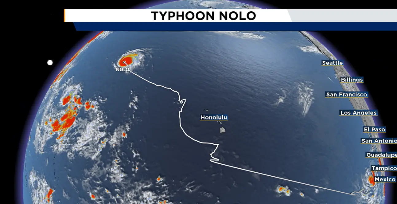
Hurricane Nolo Rapidly Intensifies Into a Rare Category 4 Storm
ORLANDO, Fla. – Hurricane Nolo has officially become a typhoon.
From a scientific standpoint, hurricanes and typhoons are the same type of storm: tropical cyclones.
The distinction comes down to the region where the storm forms or moves.
Tropical cyclones in the Atlantic, eastern Pacific and central Pacific are called hurricanes once their maximum sustained winds exceed 74 mph. In the western Pacific, storms reaching that threshold are known as typhoons.
Nolo developed into a tropical storm south of Hawaii in the central Pacific on Sept. 23.
As the system passed south of the Big Island, it prompted hurricane watches for the area.
Although Nolo weakened west of Hawaii last week, the storm rapidly strengthened again over the weekend, reaching major hurricane intensity.
The Japan Meteorological Agency and the Joint Typhoon Warning Center are monitoring the storm, with the agencies serving regional and U.S. military interests, respectively.
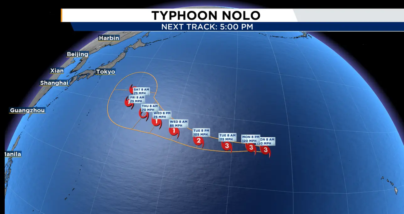
The previous storm to transition from hurricane to typhoon status was Dora in 2023.
Dora also accomplished something even more unusual. It became just the second storm on record to reach hurricane or hurricane-equivalent strength in the eastern, central and western Pacific.
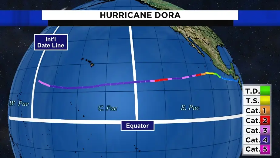
Hurricane John in 1994 is the only other known tropical cyclone to achieve that feat. John remains the longest-traveling tropical cyclone ever observed anywhere in the world. Dora, meanwhile, traveled nearly 5,000 miles across the Pacific.
Dora’s path was even more remarkable because the system was initially monitored in the Atlantic for possible tropical development before a cluster of storms formed in the Pacific. It was designated Invest 95 L, but never developed on the Atlantic side.
Dora intensified quickly and became a hurricane on Aug. 1, eventually reaching Category 4 strength. After crossing the International Dateline, Hurricane Dora was reclassified as Typhoon Dora.
The 1999 version of Hurricane Dora also came close to traveling through all three Pacific basins while remaining a hurricane.
Storms moving from the eastern Pacific into the central Pacific typically weaken as they encounter cooler water. Dora, however, remained farther south over warmer waters because of steering currents. El Niño conditions were also present in 2023.
Before Dora, Kilo in 2015 was the most recent Pacific hurricane to cross the International Dateline and become a typhoon.
Other notable hurricanes that became typhoons after crossing the International Dateline include:
Genevieve in 2014, Loke in 2006, Keoni in 1993, Ekeka in 1992, Enrique in 1991, Uleki in 1988 and Sarah in 1967.
Unlike Dora, those storms were not hurricanes in all three Pacific basins. They did, however, cross the International Dateline while still at hurricane strength and were subsequently classified as typhoons.
The 2023 storm should not be confused with Atlantic Hurricane Dora, which affected Northeast Florida in 1964.