Winter Storm Alerts: Northern California Braces for Major Snowfall and Travel Chaos
By Clara Wilson
Northern California faces a brutal weather pattern as the Presidents Day holiday weekend continues. Federal and state meteorologists have issued several winter storm alerts for the Sierra Nevada and surrounding mountain regions. As of February 15, 2026, a significant atmospheric event is moving through the state. This storm specifically targets high-elevation areas with potentially historic snow accumulation. Consequently, the National Weather Service warns of extreme danger for anyone attempting to travel through the mountains. Residents in the path of the storm must prepare for long-term power outages and isolation. The timing of the storm coincides with heavy holiday travel, which complicates emergency response efforts.
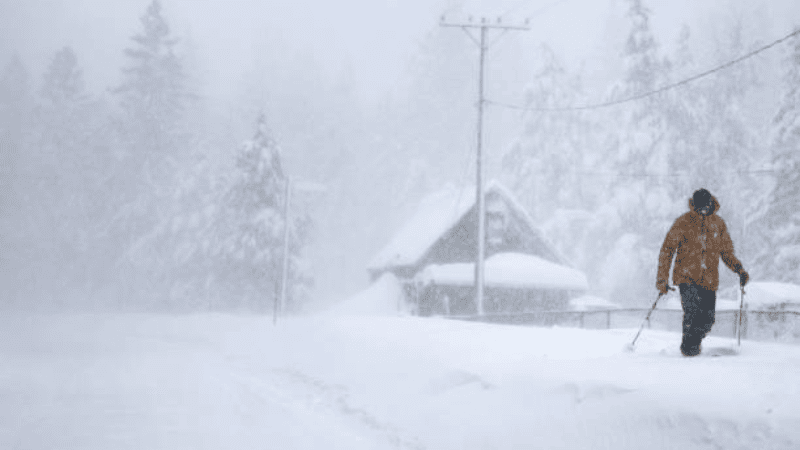
The primary threat involves a massive moisture plume colliding with cold air from the north. This combination will likely produce several feet of snow in a very short period. Furthermore, high winds will accompany the precipitation, creating life-threatening whiteout conditions. Authorities emphasize that the Sierra Nevada foothills could see snow levels drop to unusually low elevations. Specifically, snow may reach as low as 1,000 feet by Monday evening. This rare event would impact communities that rarely see significant winter weather. Emergency management teams across Northern California are currently on high alert.
Major Snowfall and Weather Warnings for the Sierra Nevada
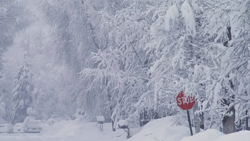
The National Weather Service has placed a Winter Storm Watch in effect through Wednesday evening. This alert covers the Sierra foothills and the main mountain passes. Meteorologists predict that higher elevations could receive between 6 and 8 feet of snow. Popular destinations like South Lake Tahoe and Blue Canyon are bracing for this significant accumulation. Additionally, the sheer weight of the snow poses a risk to trees and power lines. Many residents in these areas are already reporting light flurries as the front approaches.
The intensity of the snowfall will likely peak between Sunday night and Monday afternoon. During this window, snowfall rates could exceed three inches per hour. Such rapid accumulation makes it impossible for road crews to keep mountain passes clear. Consequently, Caltrans expects to implement long-term closures on major routes. Moreover, the low snow levels mean that even the lower foothills will face icy conditions. Residents in Shasta County are being told to finish their storm preparations by Sunday afternoon. Once the storm intensifies, mountain travel will become highly discouraged or impossible.
Significant Travel Disruptions Expected Along Interstate 5
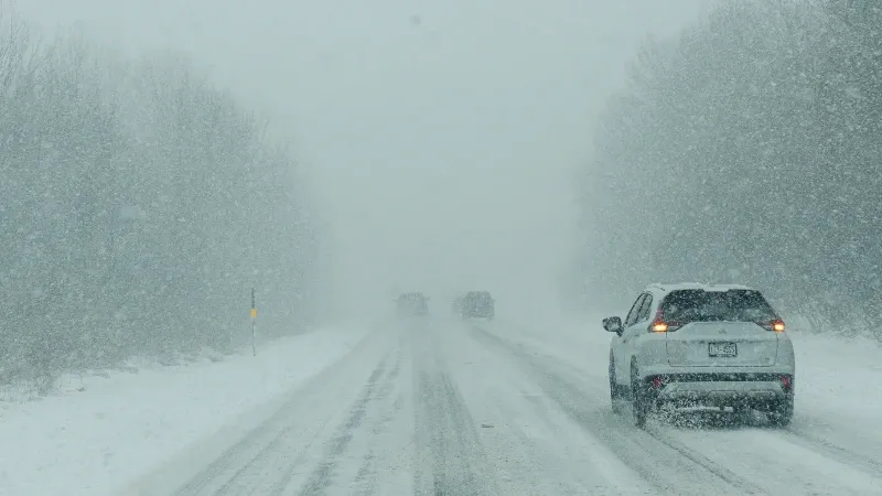
Travelers on Interstate 5 (I-5) face a difficult situation as the holiday weekend concludes. Caltrans has urged motorists to consider canceling or postponing their trips immediately. Officials anticipate aggressive vehicle screening and potential closures on I-5 near Redding and Weed. These areas often become bottleneck points when heavy snow hits the mountain passes. Specifically, the stretch between Redding and the Oregon border is a primary concern for the California Highway Patrol. Furthermore, the wind gusts could make high-profile vehicles like semi-trucks extremely difficult to handle.
In addition to the mountain passes, Southern California is facing its own weather challenges. Coastal and inland regions are bracing for a series of secondary storms moving through the area. Topanga Canyon Boulevard (SR-27) is scheduled to close on Sunday night due to high flooding risks. This closure is a proactive measure to prevent accidents in landslide-prone areas. Consequently, commuters in the Los Angeles area must find alternative routes through the canyons. The state’s infrastructure is under immense pressure as these dual weather systems impact both ends of California.
Sacramento Valley Faces Dangerous Wind and Low Snow Levels
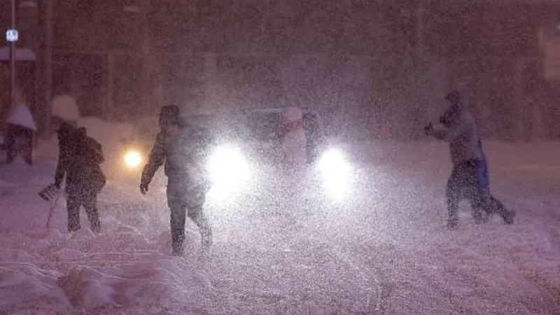
While the mountains receive the heaviest snow, the Sacramento Valley will experience dangerous wind conditions. Forecasters have issued wind advisories for the region starting Monday morning. South winds are expected to reach speeds of 15 to 25 mph. Furthermore, gusts could hit as high as 45 mph in exposed areas of the valley. These winds can easily knock down large branches and cause localized power failures. Residents should secure outdoor furniture and avoid standing near old trees during the peak of the wind event.
The dropping snow levels represent the most unusual part of this storm. Seeing snow at 1,000 feet in the valley is a rare occurrence for Northern California. This shift could lead to icy conditions on roads that are not typically treated for winter weather. Consequently, local municipalities are scrambling to distribute salt and sand to critical intersections. Public safety officials reiterate that drivers should remain at home unless travel is absolutely necessary. Even a small amount of ice on valley roads can lead to multi-vehicle accidents.
Local Perspective: The Trend of Low-Elevation Snow Events
Based on recent meteorological data from the last three winters, California is experiencing a distinct trend of high-intensity, low-elevation snow events. Specifically, the “cold core” of these Pacific storms appears to be pushing further south than in previous decades. This shift forces snow levels down into the foothills, catching many rural communities off guard. In 2026, the economic impact of these storms is magnified by the loss of holiday tourism revenue in the Sierra. When major travel hubs like South Lake Tahoe are cut off, local businesses face significant financial strain during their busiest periods.
Consequently, this storm highlights the growing need for more robust winter infrastructure in the Sacramento Valley. Many residents in the lower foothills do not possess the vehicles or equipment necessary for 1,000-foot snow levels. The state must now consider if its current fleet of snowplows is large enough to handle these expanding snow zones. Furthermore, the increased frequency of “whiteout” warnings suggests that the public needs more education on high-wind driving. This winter weather pattern is no longer just a mountain problem; it is a statewide logistics challenge.
Public Safety Guidance and Emergency Preparedness
Authorities are urging the public to take these winter storm alerts seriously. If you must travel, ensure your vehicle is equipped with tire chains, extra blankets, and a full tank of fuel. Additionally, keep an emergency kit with food and water in your car at all times. The risk of being stranded on a mountain pass is very real during this Presidents Day storm. Furthermore, residents should sign up for local emergency alerts on their smartphones. These notifications provide real-time updates on road closures and shelter locations.
The National Weather Service will continue to monitor the storm’s trajectory throughout the week. They will provide updated forecasts as the cold front moves across the state. For now, the focus remains on the next 48 hours of heavy precipitation. State officials are working with local utilities to pre-position repair crews in the foothills. The goal is to restore power as quickly as possible once the winds die down. WFB News will continue to provide updates on the storm’s impact on Northern California infrastructure.
Stay updated with the [latest Winter Storm Alerts] at wfbnews.com. You can also read about the recent [Maple Valley death investigation] that resulted in the rescue of ten children.